
The OASU Approach
Every great community begins with understanding its landscape.
Most developments begin with a masterplan. The land is acquired, the layout is designed, and environmental studies are commissioned later, often as a regulatory formality.
Oasu reversed this process. Before planning a single road, lot or amenity, the land itself was studied in depth. Environmental surveys documented every tree. Hydrological analysis traced every water channel.
These studies became the foundation for every major planning decision, not a retrospective compliance exercise, but the genuine starting point.
Environmental Analysis
Individual georeferencing of 698 trees and shrubs across 57 native species. Every specimen evaluated for preservation priority.
Hydrological Planning
120+ years of river data analysed. Natural water behaviour modelled before any infrastructure was designed.
Infrastructure planning
Roads, lots and amenities positioned only after the land’s constraints and assets were fully understood.
The Process
How Oasu was planned
01
Study the land
Topographic & vegetation survey
02
Understand Water
Hydrological analysis
03
Document Nature
Species inventory & classification
04
Design the Masterplan
Evidence-informed layout
05
Integrate Community
Community programming
06
Plan Infrastructure
Roads, utilities & drainage
Nature-First Planning
Environmental Study
Georeferenced Trees & Shrubs
Native Tree & Shrub Species
Additional Plant Species
Protected Species
Every documented tree was individually evaluated before a single planning decision was made. Every documented tree and shrub was georeferenced, identified and evaluated according to its ecological and landscape value before major planning decisions were made. This information became an important planning layer that informed the masterplan.
The Tree Decision Framework
Green
Highest Preservation Priority
Green-category specimens have the highest preservation priority and should be retained wherever feasible as part of the planning process.
Yellow
Integrated Wherever Feasible
Yellow-category specimens have secondary preservation priority and should be integrated into the development wherever planning conditions allow.
Red
Can Be Removed When Necessary
Red-category specimens may be removed when necessary for development or infrastructure according to the recommendations of the environmental study.
Environmental Planning Concepts
Responsible Biodiversity Landscaping
Climate-Smart Urban Forestry
Blue-Green Infrastructure
Biodiversity Islands
Native Landscaping
Nature-Based Solutions
Planning Tool
Every Documented Tree Received a Planning Recommendation
The environmental study did more than document existing vegetation. Each georeferenced tree and shrub was evaluated according to its ecological value, landscape importance and relevance for future planning.
The result is a practical decision framework that helps guide preservation, integration and development across the site.
Highest Preservation Priority
Secondary Preservation Priority
Can Be Removed When Necessary
Native Biodiversity
A Landscape Worth Understanding.
The environmental study documented a diverse native ecosystem characteristic of the Humid Chaco. Rather than replacing this landscape with generic ornamental planting, Oasu seeks to understand its ecological structure and use the study’s recommendations as a guide for future planning.
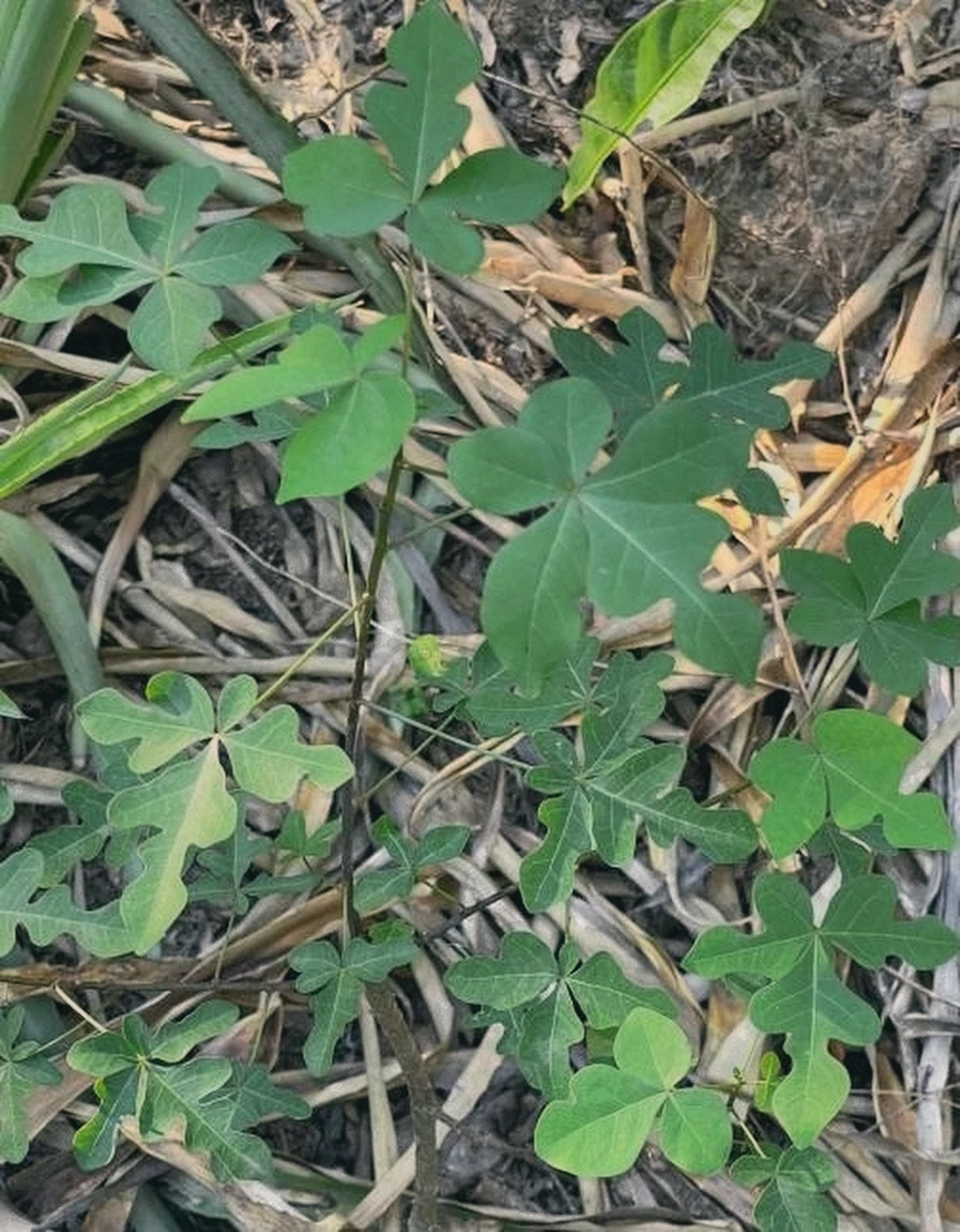
Yvy’a
Jacaratia corumbensis
An unassuming shrub of the forest understorey hiding water-storing roots that can weigh up to 250 kg. The stored liquid, unpleasant to the taste, kept people alive in the Paraguayan Chaco, indigenous communities for generations and soldiers during the Chaco War.
Ecological Role
Adapted to survive the brutal dry season of the Chaco by holding water underground. Documented in the understorey of the riparian forest on the property.
In the Community
The environmental study recommends either preserving it within a protected forest patch or carefully rescuing them for nursery propagation, and giving the species a deliberate place in the landscape for its role in Paraguayan history.
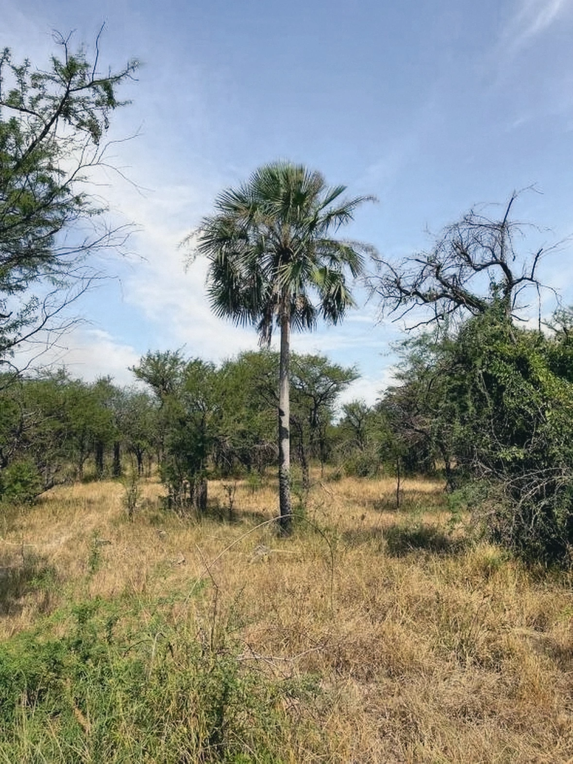
Palma Karanda’y
Copernicia alba
The Chaco fan palm that, together with the quebrachos, formed the original mosaic landscape of this land, palm savanna in the lower-lying ground, dry forest on the higher.
Ecological Role
Its flowering, usually in November at the start of the rains, is highly attractive to native and domestic bees and yields a lighter, milder honey. Its fruit feeds toucans, macaws, parrots, parakeets, crab-eating raccoon and agouti and even the pacú, a fruit-eating river fish.
In the Community
Classified as a superstar species by the environmental study and recommended for the future planting plan, both for its ecological generosity and as a defining element of the local landscape identity.
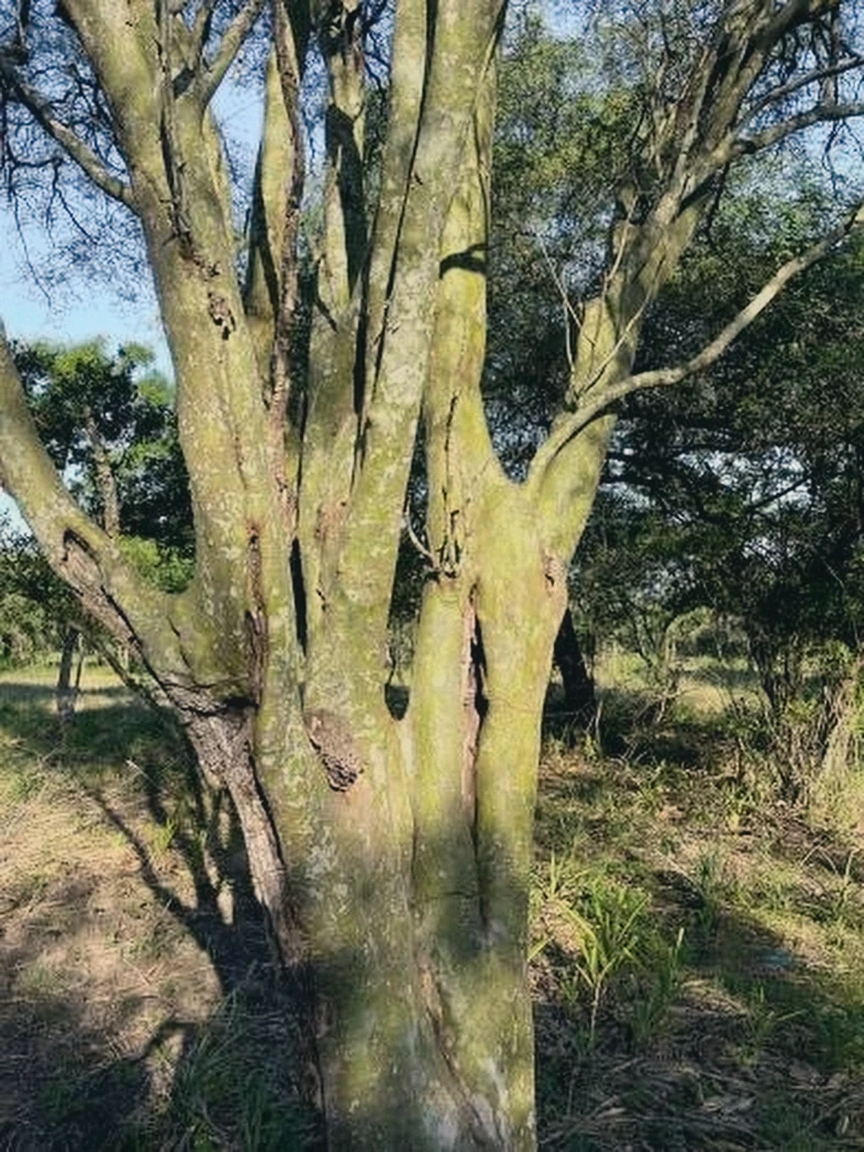
Guayacán
Libidibia paraguariensis
Listed as in danger of extinction under Paraguayan law, the strictest protection status carried by any tree documented on this property.
Ecological Role
Slow-growing and exceptionally well adapted to the site’s harsh clay soils and climate. Distinctive pale, mottled bark and light, feathery foliage that filters rather than blocks the sun.
In the Community
The environmental study recommends it as part of the planting palette, both for its contribution to thermal comfort and for the added environmental value of conserving a legally protected native species.
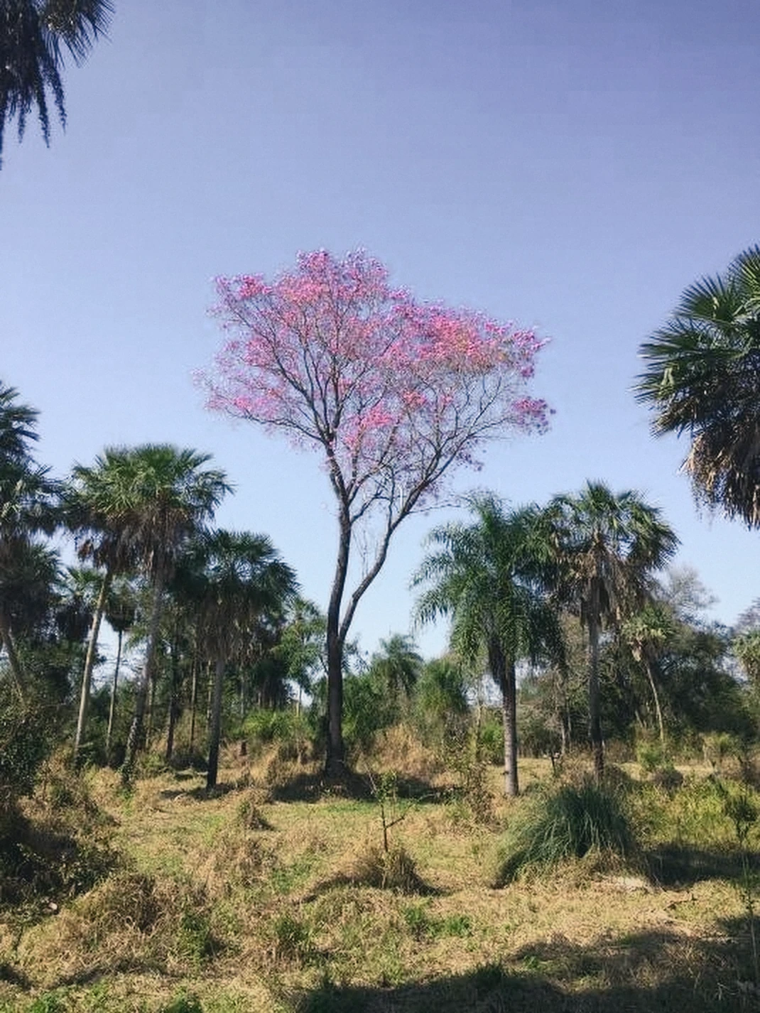
Lapacho Rosado
Handroanthus heptaphyllus
Paraguay’s national tree, known locally as tajyhũ, and one of the species on this site listed as in danger of extinction.
Ecological Role
Its long flowering season is a significant resource for wildlife during a lean part of the year, and its leaves form an important part of the howler monkey’s diet.
In the Community
All healthy specimens were marked green on the study’s decision map, the highest conservation priority. Recommended for future green spaces and native forest enrichment.
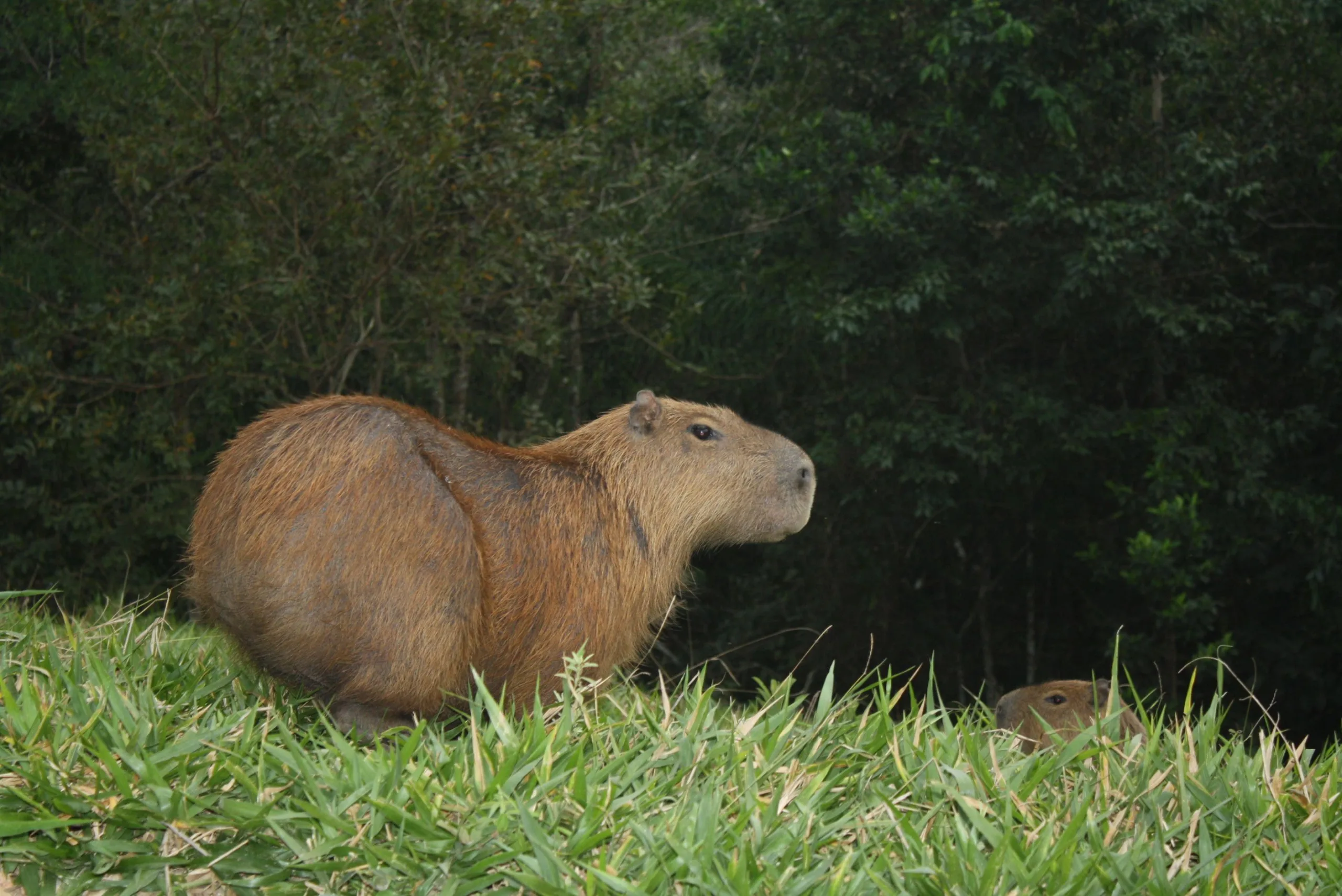
Capybara
Hydrochoerus hydrochaeris
One of the charismatic wildlife species highlighted by the environmental study as part of the site’s existing biodiversity.
Ecological Role
Represents the relationship between wetlands, biodiversity and the surrounding landscape of the Humid Chaco.
In the Community
The environmental study recommends creating ecological conditions that support native wildlife, including species such as this, wherever appropriate.
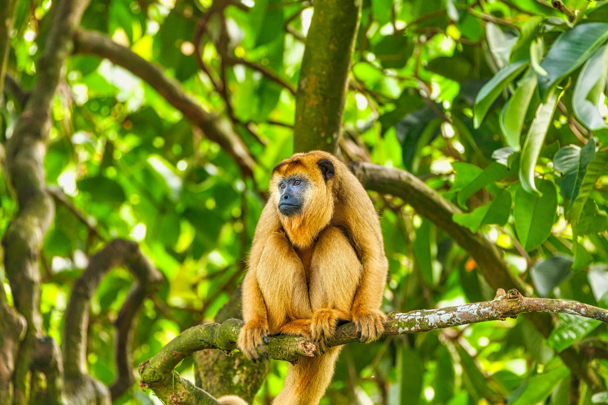
Howler Monkey
Alouatta caraya
Another charismatic wildlife species identified in the environmental study, present in the native vegetation of the site.
Ecological Role
Represents the ecological value of preserved native vegetation corridors and the biodiversity of the Humid Chaco.
In the Community
The study recommends integrating biodiversity considerations into community planning rather than isolating natural systems from built areas.
Protected Native Flora
Seven documented species appear on Paraguay’s official list of protected native flora (MADES Resolution 470/19), forming the site’s most sensitive environmental assets.
THREATENED
IN DANGER OF EXTINCTION
ECOLOGICAL ROLE
These species represent the site’s most significant ecological heritage and require particular care in any future planning decision.
IN THE COMMUNITY
The study recommends preservation, rescue, nursery propagation and future integration wherever appropriate. Healthy specimens of the protected trees were marked green on the decision map, the highest conservation priority.
The environmental study also identified 34 inventoried and 32 observed “superstar species” considered especially valuable for future landscaping, urban forestry and biodiversity integration.
Working With Water
Understanding water before building.
Water is the most powerful force shaping any landscape. Oasu commissioned a dedicated hydrological study, analysing over 120 years of river data before any infrastructure design began.
Water management considers terrain, drainage, surface runoff, road design, stormwater management and landscape integration as one integrated system, not as separate engineering problems solved in isolation.
Years of River Data
Historical records dating to 1904
Continuous Historical Record
The most comprehensive dataset available for this watershed
Hydrological Consultant
Specialist hydrological engineering firm appointed for the project
Integrated Water Strategy
Water management designed to work with natural drainage systems as recommended by the hydrological study.
Official Project Status
Officially Approved
Oasu has successfully completed the official approval process and received its final project approval from the responsible authorities.
This milestone follows environmental studies, hydrological analysis, technical planning and regulatory review, demonstrating that the project has progressed beyond concept into an officially approved development.

More Than Planning.
Official Recognition.
Research creates confidence.
Official approval creates certainty.
Before receiving final approval, Oasu completed environmental studies, hydrological analysis, technical planning and the required regulatory review process.
Receiving the official approval confirms an important milestone in the project’s development and reflects the structured planning approach behind Oasu.
The approval document is available below for anyone who wishes to review it.
Official Project Approval
Official documentation confirming that Oasu has successfully completed the required planning and approval process.
The Approbación Definitiva is available on request.
Documentation
Explore the research.
Environmental Study
Full vegetation survey and ecological classification of the site.
Hydrological Study
River data analysis and water management framework.
Environmental Photo Annex
Field photography from the environmental study survey.
OASU Master-Planned Community
Planning is only as good
as the knowledge behind it.
Oasu was not planned around assumptions, conventional lot grids or the speed of delivery. It was planned around what the land revealed when properly studied, making the research not a formality, but the foundation of everything.